Geocoding Addresses
Geocoding — converting street addresses to latitude/longitude coordinates — is fast and easy with Map Maker.
Map Maker's built-in geocoder can quickly batch geocode your addresses to coordinates. Once geocoding is completed, you can export your geocoded results to a spreadsheet file and use them however you like.
Core Concepts:
- Geocoding is managed via "tasks", which are processed by the geocoder.
- A task may contain any number of entries (up to your plan's limit).
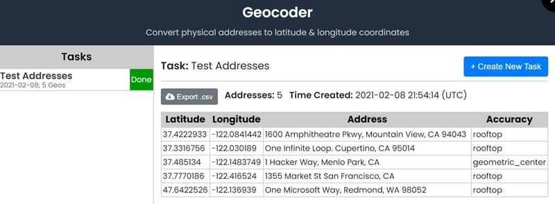
- Each result has an associated "accuracy" which denotes the result's accuracy based on the input address.
Example: Geocoding
Step 1: In the top navigation, click "Tools" and then "Batch Geocoder".
The geocoder will open.
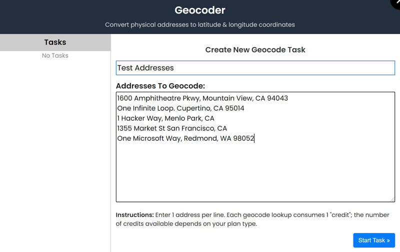
Step 2: In the geocoder, type a name for your task and copy/paste the addresses that you want to geocode (one per line).
In the example below, we have used the street addresses for some of the big tech companies:

Step 3: Click "Start Task".
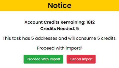
You will receive a confirmation notice with the number of credits required to complete the geocoding task. The geocoder requires 1 credit per address, and the number of credits available depends on your account plan:

Step 4: To proceed with the task, click "Proceed With Import". You can also cancel the task at this time.
After proceeding with the import, a new "In Progress" task will appear under "Tasks" in the geocoder:

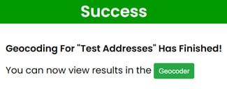
Once the geocoder finishes geocoding, the in-progress task will also change to "Done" and you will receive a pop-up notification:

Step 5: Click the task in the geocoder, and the results will load:

You can download the geocoded results by clicking the "Export .csv" button.
NOTES:
- The amount of time it takes for a task to complete depends on: 1) how busy the geocoder currently is with other tasks, and 2) the number of addresses in your task. Generally, for tasks with under 100 addresses, the geocoder should take no more than 3 minutes.
 Map Maker