Map Maker Help

Map Maker is a powerful yet easy-to-use system for making, plotting, editing and sharing maps.
Map Maker Features:
- Create maps with multiple data layers.
- Bulk import location data using .csv file format or simple copy/paste.
- Click any point on the map to view geocode details or add the point to a layer.
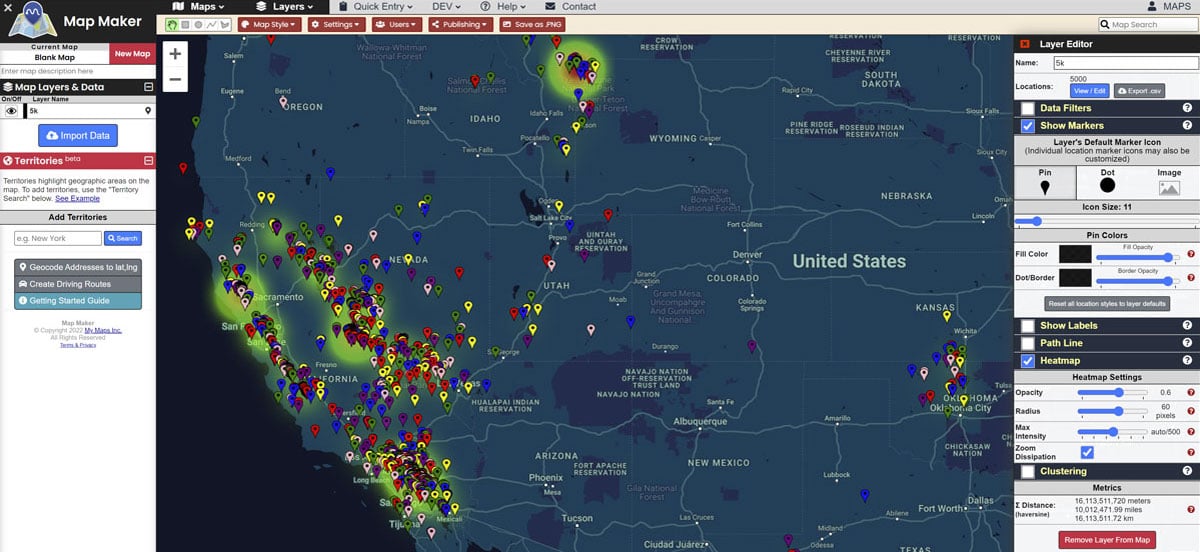
- Analyze data with heatmaps, clustering, lines, distance measuring and more.
- Upload custom images as markers and icons.
- Use Google Maps data to search for cities, locations, businesses, etc.
- Share maps publicly or only give permission to specific users.
- View your current GPS location coordinates.
- Export screenshots of maps for use in presentations, online, etc.
- And much more. If you need a specific feature, please submit a request.
Getting Started
When you visit the Map Maker for the very first time as an unregistered user, a temporary account with a demo map is created for you. You may edit the demo map, create a new blank map from which to work, or otherwise continue to use the Map Maker as an unregistered user.
Important: Registering an account is optional but highly recommended so that your work is saved. Temporary account data for unregistered users is periodically purged from the system.
Map Locations & Data Are Stored In "Layers"
Layers act as "containers" for data. You can think of them as categories or file folders, helping you to organize your location data into manageable groups. When you import location data, a layer containing the locations will be created.
Layers exist independently of maps and the same layer can be shared on multiple maps simultaneously. This means you don't need to re-import the same data every time you create a new map. Instead, you can simply load a layer you created earlier onto the current map. All layer location data and settings will be imported.
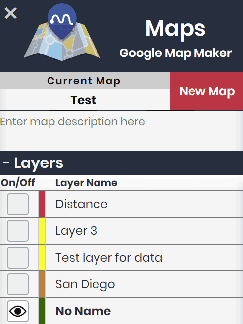
The "Layer List" in the left panel shows the layers that are active on the current map. You can toggle a layer ON or OFF by clicking the box to the left of the layer's color
The Layer List:

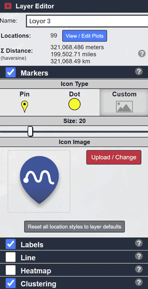
Clicking on a layer in the Layer List will open the "Layer Editor" to the right side of the page.
The Layer Editor allows you to customize the layer and how the layer's data appears on the map.
The Layer Editor:

 Map Maker